GPS and Telemetry.
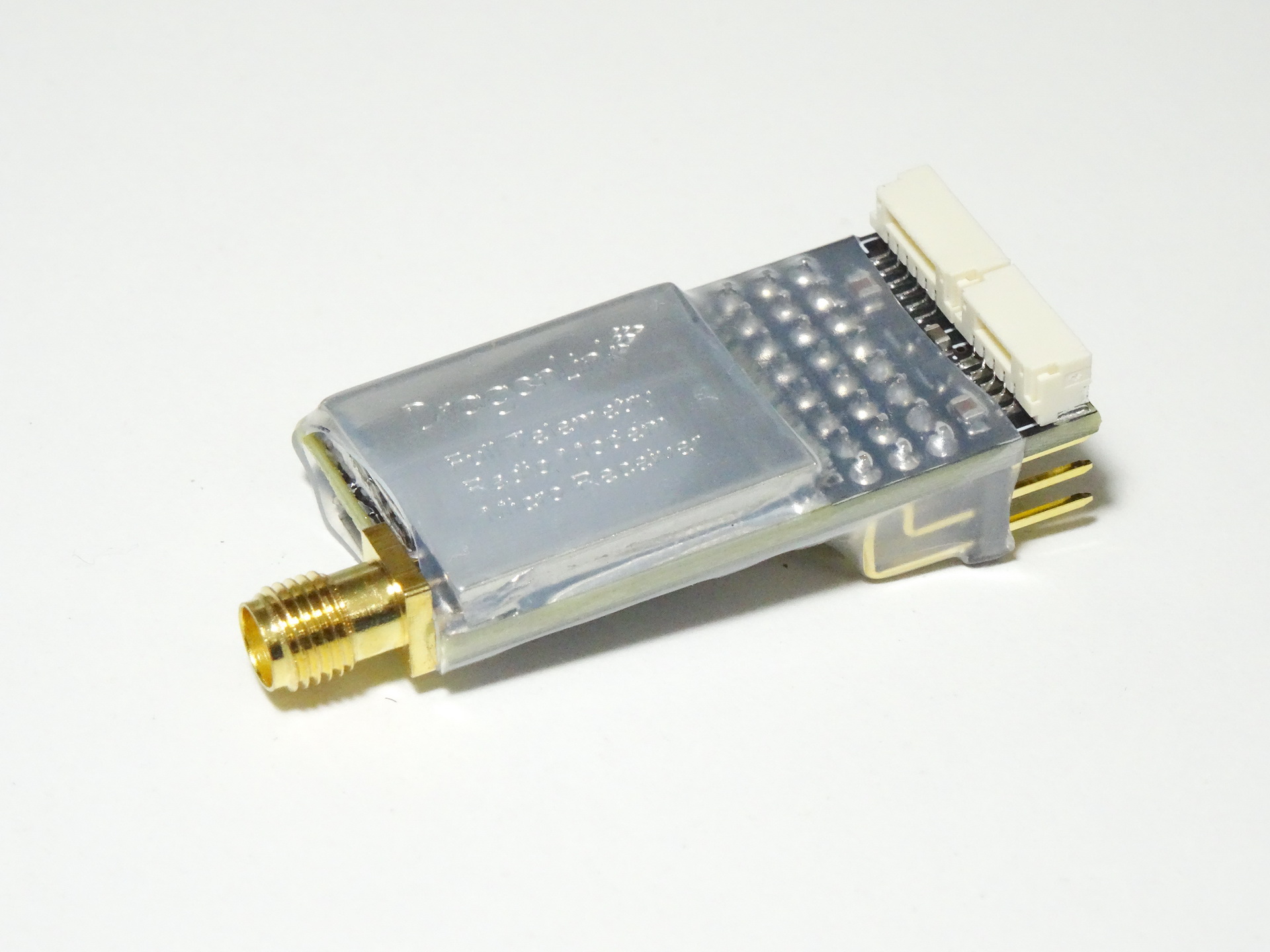
The Dragon Link Micro receiver is a full telemetry receiver, and will send GPS and basic telemetry approximately 15 Kilometers range with stock antennas. The RC control range of the Micro Receiver is approximately 60 Kilometers with stock antennas, but the Telemetry range of the Micro Receiver is much shorter than RC range because the power output of the Micro Receiver is only 25 mW. If you need long range telemetry we suggest using the full power 1500 mW Long range telemetry receiver. There are several different telemetry options you can use:
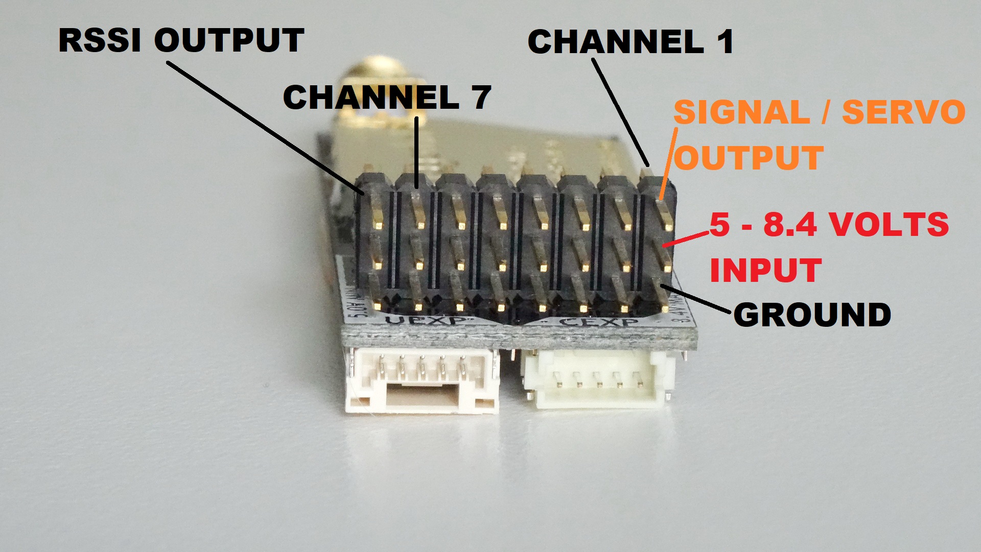
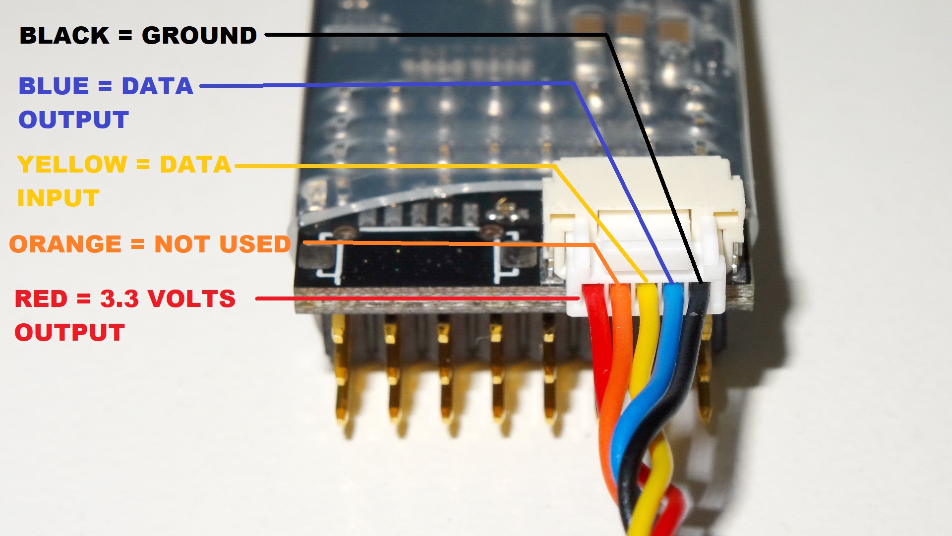
GPS TELEMETRY ( HIGHLY RECOMMENDED FOR ALL SYSTEMS ): This is the longest range, highest performance telemetry option. Typical GPS telemetry range is with the micro receiver is about 15 Kilometers since the micro receiver only outputs 25 mW. Connect any standard GPS to your Micro Receiver for full GPS position displayed on a moving map, and displays, altitude, course, and speed. Map and data is displayed on a Tablet, phone or laptop using TOWER for Android or MISSION Planner for Windows. You can connect GPS to your micro receiver via the UEXP port or any of the servo pins as shown in the pictures below.
MAVLINK: Mavlink uses a very high data rate which is very inefficient and reduces telemetry range by a huge amount. Typical telemetry range using Mavlink is approximately 5 Kilometers. You can connect any Mavlink device to your receiver, and get full Mavlink functionality via the Radio Modem Feature of the Dragon Link system.
PIXHAWK: Pixhawk uses Mavlink, which has a very high data rate which is very inefficient and reduces telemetry range by a huge amount. Typical telemetry range using Pixhawk full telemetry is approximately 5 Kilometers. The advtange to Pixhawk is that it Provides a FULL FLIGHT DISPLAY with artificial horizon, Position on Map, and full GPS information. Displayed on a Tablet, Phone, Or Laptop using Mission Planner / Droid Planner. See the special Pixhawk setup section for full details.
EAGLE TREE VECTOR: Provides FULL FLIGHT DISPLAY with artificial horizon, Position on Map, and full GPS information. Displayed on a Tablet, Phone, Or Laptop using Mission Planner / Droid Planner. See the special Eagle Tree Vector setup section for full details.


